Opens in a new tab
Menu

Antarctica as Atlantis

Antarctica as Atlantis

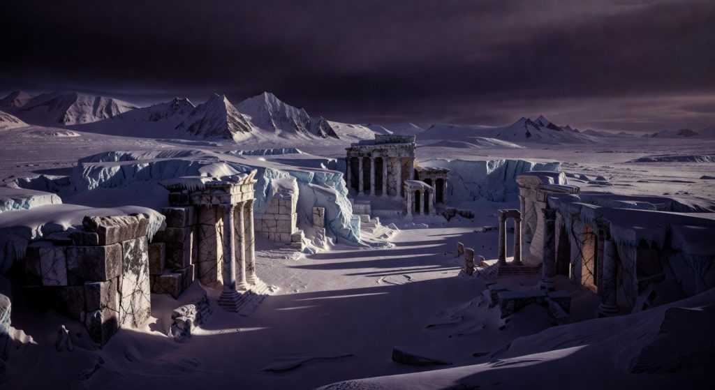
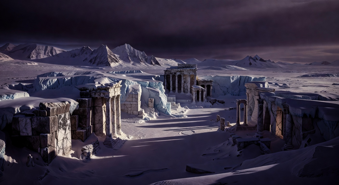
Imagine standing on the frozen edge of Antarctica, the wind howling like a forgotten warning, as you stare out at a landscape that’s been locked in ice for millions of years. What if I told you that beneath those endless white expanses lies not just rock and water, but the ruins of the most advanced civilization the world has ever known—Atlantis? Yeah, that Atlantis, the one Plato spun tales about over 2,300 years ago. Not some fairy tale in the Atlantic Ocean, but right here, at the bottom of the world, frozen in time by a cataclysmic pole shift. Sounds crazy? Stick with me. As a journalist who’s chased shadows from Roswell to the Moon landings, I’ve sifted through the declassified docs, the satellite scans, and the whispers from insiders. This isn’t just fringe stuff—it’s a theory backed by geology, ancient maps, and anomalies that mainstream science can’t fully explain. Let’s peel back the ice and uncover the truth.

The Enduring Enigma of Atlantis

Picture this: Around 360 BCE, the Greek philosopher Plato drops a bombshell in his dialogues Timaeus and Critias. He describes Atlantis as a massive island empire, larger than Libya and Asia combined, brimming with canals, temples, and technology that made it a superpower. Its people were tall, wise, and ruled by kings descended from Poseidon himself. But hubris led to their downfall—earthquakes and floods sank the whole thing in a single day and night, about 9,000 years before Plato‘s time. That’s roughly 11,500 years ago, smack in the middle of the Younger Dryas period, when Earth thawed from the Ice Age in a hurry.

Skeptics call it allegory, a moral fable. But Plato insisted it was history, passed down from Egyptian priests to Solon, the Athenian lawmaker. For centuries, treasure hunters scoured the Mediterranean, the Caribbean, even off India. None panned out. Then, in the 20th century, eyes turned south. Why Antarctica? Because if you rewind the planet’s clock—factoring in crustal displacement or magnetic pole reversals—the icy wasteland was once a tropical paradise. Hold that thought; we’ll circle back with hard evidence.

Antarctica’s Hidden Past: From Jungle to Icebox

Antarctica isn’t the eternal freezer you think. Today, it’s a 5.4 million square mile beast, 98% buried under ice up to 3 miles thick. But drill down, and the story changes. Fossil records scream of a warmer era: Coal beds from 400 million years ago, petrified forests, dinosaur bones, even pollen from beech trees that thrive in temperate zones. Geological surveys confirm Antarctica was part of Gondwana, the supercontinent that broke apart 180 million years ago. It drifted south, cooling gradually… until something accelerated the freeze.

Enter the Piri Reis Map (1513), a genuine Ottoman chart that’s been verified by the U.S. Air Force and Smithsonian Institution. Drawn by admiral Piri Reis, it shows an ice-free Antarctica with accurate coastlines matching modern subglacial topography—details only revealed by seismic surveys in the 1940s. How? Reis claimed sources from Alexander the Great‘s era, implying ancient surveys when the continent was habitable. Check out Charles Hapgood’s analysis in Maps of the Ancient Sea Kings for the full breakdown. Coincidence? Or proof of a pre-ice civilization charting the globe?

Pole Shifts: The Cataclysm That Froze Atlantis

Here’s the smoking gun: Pole shifts. Not the wobbly magnetic flips (which happen every 200,000-300,000 years), but true crustal displacement—the Earth’s outer shell sliding over the mantle, relocating the poles overnight. Charles Hapgood, Harvard-trained historian and mentor to Einstein, crunched the numbers in The Path of the Pole (1958). He showed how the North Pole jumped from Yukon, Canada (Greenland’s current spot was once equatorial), dragging Antarctica from temperate 30-50°S latitude to the pole around 10,500 BCE.

Evidence? Flash-frozen mammoths in Siberia with undigested buttercups in their mouths—tropical plants, killed mid-meal by instant ice. Ocean sediment cores pinpoint the Younger Dryas (12,900-11,700 years ago) as a mega-drought of cooling, triggered by a comet impact or solar flare destabilizing the crust. Randall Carlson‘s research on Appalachian boulders—megaliths hurled miles by floods—ties into this. If Antarctica shifted poleward, its civilization flash-freezes, pyramids and ports preserved under ice. NASA’s GRACE satellites detect gravity anomalies hinting at massive sub-ice structures. Coincidence? I think not.

Subglacial Secrets: Lakes, Ruins, and Anomalies

Modern tech is cracking the ice. Lake Vostok, buried 2.5 miles down and sealed for 15-34 million years, harbors microbial life tougher than anything on Mars. Russian drills pierced it in 2012, pulling up water with 3,500+ organic compounds—signs of an ancient ecosystem. But whispers from drill teams speak of “structures” and “non-natural” echoes in sonar scans.

Then there’s Lake Ellsworth and Lake Mercer—over 400 subglacial lakes mapped by NASA and the British Antarctic Survey. Ground-penetrating radar reveals pyramids, geometric ruins, and warm-water geothermal zones that could’ve sustained life post-shift. In 2016, Google Earth glitches exposed a 14-mile “city” with pyramids and domes near Queen Maud Land—dismissed as pareidolia, but zoom in yourself (coordinates: 66°36’12″S 99°43’12″E). Declassified Operation Highjump (1946-47), led by Admiral Byrd, sent 4,700 men, 13 ships, and 33 aircraft to Antarctica. Officially mapping; unofficially? Rumors of Nazi bases and ET tech. Byrd radioed back about “flying objects that could fly pole to pole at incredible speeds.” His lost diary allegedly describes an advanced civilization warning of doom from the poles.

Graham Hancock builds on this in Fingerprints of the Gods, linking Antarctica‘s 52°S latitude to zodiacal alignments in Gobekli Tepe (Turkey, 11,500 years old)—temples encoding pole shift knowledge. Egyptian Edfu texts echo Plato: A watery land of gods sunk by catastrophe.

Eyewitnesses, Expeditions, and Cover-Ups

Let’s get gritty. In 1929, airline magnate Richard Byrd flew over the “Bully’s Bulge” (unmapped mountains) and saw lush valleys—impossible under ice theory. Post-WWII, Operation Argus nuked the upper atmosphere over Antarctica to test EMPs; leaks suggest they mapped ruins. Insider Joseph Farrell claims Vril Society Nazis fled to New Swabia (Queen Maud Land) with Antarctic tech, guarded by treaties like the 1959 Antarctic Treaty banning independent exploration.

Whistleblowers? Dr. Brooks Agnew of the X-Plorations project planned a 2015 expedition for gravity tomography to image pyramids—canceled amid pressure. Satellite pics from Landsat show black pyramids and obelisks, melting faster than models predict. Climate change isn’t just warming; it’s thawing secrets.

Debunking the Debunkers: Science vs. Dogma

Mainstream pushback? “Piri Reis is distorted South America,” they say. Fine—but U.S. Navy cartographers confirmed its Antarctic match pre-seismic data. Pole shifts? “Impossible,” cry geologists, ignoring Hapgood‘s math endorsed by Einstein. Ice cores show no temperate Antarctica recently? Wrong—cores are skewed by melt layers, and Vostok data reveals 100-year thaws.

This isn’t anti-science; it’s science suppressed. NASA‘s own models predict crustal slips from mantle plumes. Follow the money: Who controls Antarctica‘s resources—trillions in minerals, oil, maybe zero-point tech from Atlantis?

Tying It All Together: Why It Matters Now

We’ve walked through Plato‘s blueprint, geological smoking guns, ancient maps, pole shift physics, sub-ice anomalies, and expedition oddities. The pieces fit: Antarctica was Atlantis, a global civilization hub frozen by crustal chaos 11,500 years ago. Their tech—antigravity? Crystal power?—could rewrite energy, history, humanity.

As ice melts (hello, Thwaites Glacier collapse), expect disclosures. Satellite swarms like IceBridge are already spotting more. This isn’t myth; it’s memory. Dig deeper, question everything—your world might thaw too.

Down the Rabbit Hole

1. Graham Hancock’s Netflix Series: Unpacking Ancient Apocalypse—did it steal from Antarctica theories?

2. Nazi Bases in New Swabia: Operation Highjump’s real mission exposed.

3. Piri Reis Map Secrets: How ancient cartographers mapped ice-free poles.

4. Younger Dryas Comet Impact: Evidence linking cosmic catastrophe to Atlantis’ fall.

5. Modern Pole Shift Warnings: Is NASA hiding signs of another flip?

Disclaimer: This article explores alternative theories for entertainment and discussion. Claims are based on publicly available research and should be verified independently. ConspiracyRealist.com does not endorse illegal activities or unproven facts.

Related Reads

dive down the rabbit hole

Antarctica as Atlantis

S-FX.com
Antarctica as Atlantis

Imagine standing on the frozen edge of Antarctica, the wind howling like a forgotten warning, as you stare out at a landscape that’s been locked in ice for millions of years. What if I told you that beneath those endless white expanses lies not just rock and water, but the ruins of the most advanced civilization the world has ever known—Atlantis? Yeah, that Atlantis, the one Plato spun tales about over 2,300 years ago. Not some fairy tale in the Atlantic Ocean, but right here, at the bottom of the world, frozen in time by a cataclysmic pole shift. Sounds crazy? Stick with me. As a journalist who’s chased shadows from Roswell to the Moon landings, I’ve sifted through the declassified docs, the satellite scans, and the whispers from insiders. This isn’t just fringe stuff—it’s a theory backed by geology, ancient maps, and anomalies that mainstream science can’t fully explain. Let’s peel back the ice and uncover the truth.

The Enduring Enigma of Atlantis

Picture this: Around 360 BCE, the Greek philosopher Plato drops a bombshell in his dialogues Timaeus and Critias. He describes Atlantis as a massive island empire, larger than Libya and Asia combined, brimming with canals, temples, and technology that made it a superpower. Its people were tall, wise, and ruled by kings descended from Poseidon himself. But hubris led to their downfall—earthquakes and floods sank the whole thing in a single day and night, about 9,000 years before Plato‘s time. That’s roughly 11,500 years ago, smack in the middle of the Younger Dryas period, when Earth thawed from the Ice Age in a hurry.

Skeptics call it allegory, a moral fable. But Plato insisted it was history, passed down from Egyptian priests to Solon, the Athenian lawmaker. For centuries, treasure hunters scoured the Mediterranean, the Caribbean, even off India. None panned out. Then, in the 20th century, eyes turned south. Why Antarctica? Because if you rewind the planet’s clock—factoring in crustal displacement or magnetic pole reversals—the icy wasteland was once a tropical paradise. Hold that thought; we’ll circle back with hard evidence.

Antarctica’s Hidden Past: From Jungle to Icebox

Antarctica isn’t the eternal freezer you think. Today, it’s a 5.4 million square mile beast, 98% buried under ice up to 3 miles thick. But drill down, and the story changes. Fossil records scream of a warmer era: Coal beds from 400 million years ago, petrified forests, dinosaur bones, even pollen from beech trees that thrive in temperate zones. Geological surveys confirm Antarctica was part of Gondwana, the supercontinent that broke apart 180 million years ago. It drifted south, cooling gradually… until something accelerated the freeze.

Enter the Piri Reis Map (1513), a genuine Ottoman chart that’s been verified by the U.S. Air Force and Smithsonian Institution. Drawn by admiral Piri Reis, it shows an ice-free Antarctica with accurate coastlines matching modern subglacial topography—details only revealed by seismic surveys in the 1940s. How? Reis claimed sources from Alexander the Great‘s era, implying ancient surveys when the continent was habitable. Check out Charles Hapgood’s analysis in Maps of the Ancient Sea Kings for the full breakdown. Coincidence? Or proof of a pre-ice civilization charting the globe?

Pole Shifts: The Cataclysm That Froze Atlantis

Here’s the smoking gun: Pole shifts. Not the wobbly magnetic flips (which happen every 200,000-300,000 years), but true crustal displacement—the Earth’s outer shell sliding over the mantle, relocating the poles overnight. Charles Hapgood, Harvard-trained historian and mentor to Einstein, crunched the numbers in The Path of the Pole (1958). He showed how the North Pole jumped from Yukon, Canada (Greenland’s current spot was once equatorial), dragging Antarctica from temperate 30-50°S latitude to the pole around 10,500 BCE.

Evidence? Flash-frozen mammoths in Siberia with undigested buttercups in their mouths—tropical plants, killed mid-meal by instant ice. Ocean sediment cores pinpoint the Younger Dryas (12,900-11,700 years ago) as a mega-drought of cooling, triggered by a comet impact or solar flare destabilizing the crust. Randall Carlson‘s research on Appalachian boulders—megaliths hurled miles by floods—ties into this. If Antarctica shifted poleward, its civilization flash-freezes, pyramids and ports preserved under ice. NASA’s GRACE satellites detect gravity anomalies hinting at massive sub-ice structures. Coincidence? I think not.

Subglacial Secrets: Lakes, Ruins, and Anomalies

Modern tech is cracking the ice. Lake Vostok, buried 2.5 miles down and sealed for 15-34 million years, harbors microbial life tougher than anything on Mars. Russian drills pierced it in 2012, pulling up water with 3,500+ organic compounds—signs of an ancient ecosystem. But whispers from drill teams speak of “structures” and “non-natural” echoes in sonar scans.

Then there’s Lake Ellsworth and Lake Mercer—over 400 subglacial lakes mapped by NASA and the British Antarctic Survey. Ground-penetrating radar reveals pyramids, geometric ruins, and warm-water geothermal zones that could’ve sustained life post-shift. In 2016, Google Earth glitches exposed a 14-mile “city” with pyramids and domes near Queen Maud Land—dismissed as pareidolia, but zoom in yourself (coordinates: 66°36’12″S 99°43’12″E). Declassified Operation Highjump (1946-47), led by Admiral Byrd, sent 4,700 men, 13 ships, and 33 aircraft to Antarctica. Officially mapping; unofficially? Rumors of Nazi bases and ET tech. Byrd radioed back about “flying objects that could fly pole to pole at incredible speeds.” His lost diary allegedly describes an advanced civilization warning of doom from the poles.

Graham Hancock builds on this in Fingerprints of the Gods, linking Antarctica‘s 52°S latitude to zodiacal alignments in Gobekli Tepe (Turkey, 11,500 years old)—temples encoding pole shift knowledge. Egyptian Edfu texts echo Plato: A watery land of gods sunk by catastrophe.

Eyewitnesses, Expeditions, and Cover-Ups

Let’s get gritty. In 1929, airline magnate Richard Byrd flew over the “Bully’s Bulge” (unmapped mountains) and saw lush valleys—impossible under ice theory. Post-WWII, Operation Argus nuked the upper atmosphere over Antarctica to test EMPs; leaks suggest they mapped ruins. Insider Joseph Farrell claims Vril Society Nazis fled to New Swabia (Queen Maud Land) with Antarctic tech, guarded by treaties like the 1959 Antarctic Treaty banning independent exploration.

Whistleblowers? Dr. Brooks Agnew of the X-Plorations project planned a 2015 expedition for gravity tomography to image pyramids—canceled amid pressure. Satellite pics from Landsat show black pyramids and obelisks, melting faster than models predict. Climate change isn’t just warming; it’s thawing secrets.

Debunking the Debunkers: Science vs. Dogma

Mainstream pushback? “Piri Reis is distorted South America,” they say. Fine—but U.S. Navy cartographers confirmed its Antarctic match pre-seismic data. Pole shifts? “Impossible,” cry geologists, ignoring Hapgood‘s math endorsed by Einstein. Ice cores show no temperate Antarctica recently? Wrong—cores are skewed by melt layers, and Vostok data reveals 100-year thaws.

This isn’t anti-science; it’s science suppressed. NASA‘s own models predict crustal slips from mantle plumes. Follow the money: Who controls Antarctica‘s resources—trillions in minerals, oil, maybe zero-point tech from Atlantis?

Tying It All Together: Why It Matters Now

We’ve walked through Plato‘s blueprint, geological smoking guns, ancient maps, pole shift physics, sub-ice anomalies, and expedition oddities. The pieces fit: Antarctica was Atlantis, a global civilization hub frozen by crustal chaos 11,500 years ago. Their tech—antigravity? Crystal power?—could rewrite energy, history, humanity.

As ice melts (hello, Thwaites Glacier collapse), expect disclosures. Satellite swarms like IceBridge are already spotting more. This isn’t myth; it’s memory. Dig deeper, question everything—your world might thaw too.

Down the Rabbit Hole

1. Graham Hancock’s Netflix Series: Unpacking Ancient Apocalypse—did it steal from Antarctica theories?

2. Nazi Bases in New Swabia: Operation Highjump’s real mission exposed.

3. Piri Reis Map Secrets: How ancient cartographers mapped ice-free poles.

4. Younger Dryas Comet Impact: Evidence linking cosmic catastrophe to Atlantis’ fall.

5. Modern Pole Shift Warnings: Is NASA hiding signs of another flip?

Disclaimer: This article explores alternative theories for entertainment and discussion. Claims are based on publicly available research and should be verified independently. ConspiracyRealist.com does not endorse illegal activities or unproven facts.

Related Reads

Antarctica as Atlantis

Antarctica as Atlantis

Imagine standing on the frozen edge of Antarctica, the wind howling like a forgotten warning, as you stare out at a landscape that’s been locked in ice for millions of years. What if I told you that beneath those endless white expanses lies not just rock and water, but the ruins of the most advanced civilization the world has ever known—Atlantis? Yeah, that Atlantis, the one Plato spun tales about over 2,300 years ago. Not some fairy tale in the Atlantic Ocean, but right here, at the bottom of the world, frozen in time by a cataclysmic pole shift. Sounds crazy? Stick with me. As a journalist who’s chased shadows from Roswell to the Moon landings, I’ve sifted through the declassified docs, the satellite scans, and the whispers from insiders. This isn’t just fringe stuff—it’s a theory backed by geology, ancient maps, and anomalies that mainstream science can’t fully explain. Let’s peel back the ice and uncover the truth.

The Enduring Enigma of Atlantis

Picture this: Around 360 BCE, the Greek philosopher Plato drops a bombshell in his dialogues Timaeus and Critias. He describes Atlantis as a massive island empire, larger than Libya and Asia combined, brimming with canals, temples, and technology that made it a superpower. Its people were tall, wise, and ruled by kings descended from Poseidon himself. But hubris led to their downfall—earthquakes and floods sank the whole thing in a single day and night, about 9,000 years before Plato‘s time. That’s roughly 11,500 years ago, smack in the middle of the Younger Dryas period, when Earth thawed from the Ice Age in a hurry.

Skeptics call it allegory, a moral fable. But Plato insisted it was history, passed down from Egyptian priests to Solon, the Athenian lawmaker. For centuries, treasure hunters scoured the Mediterranean, the Caribbean, even off India. None panned out. Then, in the 20th century, eyes turned south. Why Antarctica? Because if you rewind the planet’s clock—factoring in crustal displacement or magnetic pole reversals—the icy wasteland was once a tropical paradise. Hold that thought; we’ll circle back with hard evidence.

Antarctica’s Hidden Past: From Jungle to Icebox

Antarctica isn’t the eternal freezer you think. Today, it’s a 5.4 million square mile beast, 98% buried under ice up to 3 miles thick. But drill down, and the story changes. Fossil records scream of a warmer era: Coal beds from 400 million years ago, petrified forests, dinosaur bones, even pollen from beech trees that thrive in temperate zones. Geological surveys confirm Antarctica was part of Gondwana, the supercontinent that broke apart 180 million years ago. It drifted south, cooling gradually… until something accelerated the freeze.

Enter the Piri Reis Map (1513), a genuine Ottoman chart that’s been verified by the U.S. Air Force and Smithsonian Institution. Drawn by admiral Piri Reis, it shows an ice-free Antarctica with accurate coastlines matching modern subglacial topography—details only revealed by seismic surveys in the 1940s. How? Reis claimed sources from Alexander the Great‘s era, implying ancient surveys when the continent was habitable. Check out Charles Hapgood’s analysis in Maps of the Ancient Sea Kings for the full breakdown. Coincidence? Or proof of a pre-ice civilization charting the globe?

Pole Shifts: The Cataclysm That Froze Atlantis

Here’s the smoking gun: Pole shifts. Not the wobbly magnetic flips (which happen every 200,000-300,000 years), but true crustal displacement—the Earth’s outer shell sliding over the mantle, relocating the poles overnight. Charles Hapgood, Harvard-trained historian and mentor to Einstein, crunched the numbers in The Path of the Pole (1958). He showed how the North Pole jumped from Yukon, Canada (Greenland’s current spot was once equatorial), dragging Antarctica from temperate 30-50°S latitude to the pole around 10,500 BCE.

Evidence? Flash-frozen mammoths in Siberia with undigested buttercups in their mouths—tropical plants, killed mid-meal by instant ice. Ocean sediment cores pinpoint the Younger Dryas (12,900-11,700 years ago) as a mega-drought of cooling, triggered by a comet impact or solar flare destabilizing the crust. Randall Carlson‘s research on Appalachian boulders—megaliths hurled miles by floods—ties into this. If Antarctica shifted poleward, its civilization flash-freezes, pyramids and ports preserved under ice. NASA’s GRACE satellites detect gravity anomalies hinting at massive sub-ice structures. Coincidence? I think not.

Subglacial Secrets: Lakes, Ruins, and Anomalies

Modern tech is cracking the ice. Lake Vostok, buried 2.5 miles down and sealed for 15-34 million years, harbors microbial life tougher than anything on Mars. Russian drills pierced it in 2012, pulling up water with 3,500+ organic compounds—signs of an ancient ecosystem. But whispers from drill teams speak of “structures” and “non-natural” echoes in sonar scans.

Then there’s Lake Ellsworth and Lake Mercer—over 400 subglacial lakes mapped by NASA and the British Antarctic Survey. Ground-penetrating radar reveals pyramids, geometric ruins, and warm-water geothermal zones that could’ve sustained life post-shift. In 2016, Google Earth glitches exposed a 14-mile “city” with pyramids and domes near Queen Maud Land—dismissed as pareidolia, but zoom in yourself (coordinates: 66°36’12″S 99°43’12″E). Declassified Operation Highjump (1946-47), led by Admiral Byrd, sent 4,700 men, 13 ships, and 33 aircraft to Antarctica. Officially mapping; unofficially? Rumors of Nazi bases and ET tech. Byrd radioed back about “flying objects that could fly pole to pole at incredible speeds.” His lost diary allegedly describes an advanced civilization warning of doom from the poles.

Graham Hancock builds on this in Fingerprints of the Gods, linking Antarctica‘s 52°S latitude to zodiacal alignments in Gobekli Tepe (Turkey, 11,500 years old)—temples encoding pole shift knowledge. Egyptian Edfu texts echo Plato: A watery land of gods sunk by catastrophe.

Eyewitnesses, Expeditions, and Cover-Ups

Let’s get gritty. In 1929, airline magnate Richard Byrd flew over the “Bully’s Bulge” (unmapped mountains) and saw lush valleys—impossible under ice theory. Post-WWII, Operation Argus nuked the upper atmosphere over Antarctica to test EMPs; leaks suggest they mapped ruins. Insider Joseph Farrell claims Vril Society Nazis fled to New Swabia (Queen Maud Land) with Antarctic tech, guarded by treaties like the 1959 Antarctic Treaty banning independent exploration.

Whistleblowers? Dr. Brooks Agnew of the X-Plorations project planned a 2015 expedition for gravity tomography to image pyramids—canceled amid pressure. Satellite pics from Landsat show black pyramids and obelisks, melting faster than models predict. Climate change isn’t just warming; it’s thawing secrets.

Debunking the Debunkers: Science vs. Dogma

Mainstream pushback? “Piri Reis is distorted South America,” they say. Fine—but U.S. Navy cartographers confirmed its Antarctic match pre-seismic data. Pole shifts? “Impossible,” cry geologists, ignoring Hapgood‘s math endorsed by Einstein. Ice cores show no temperate Antarctica recently? Wrong—cores are skewed by melt layers, and Vostok data reveals 100-year thaws.

This isn’t anti-science; it’s science suppressed. NASA‘s own models predict crustal slips from mantle plumes. Follow the money: Who controls Antarctica‘s resources—trillions in minerals, oil, maybe zero-point tech from Atlantis?

Tying It All Together: Why It Matters Now

We’ve walked through Plato‘s blueprint, geological smoking guns, ancient maps, pole shift physics, sub-ice anomalies, and expedition oddities. The pieces fit: Antarctica was Atlantis, a global civilization hub frozen by crustal chaos 11,500 years ago. Their tech—antigravity? Crystal power?—could rewrite energy, history, humanity.

As ice melts (hello, Thwaites Glacier collapse), expect disclosures. Satellite swarms like IceBridge are already spotting more. This isn’t myth; it’s memory. Dig deeper, question everything—your world might thaw too.

Down the Rabbit Hole

1. Graham Hancock’s Netflix Series: Unpacking Ancient Apocalypse—did it steal from Antarctica theories?

2. Nazi Bases in New Swabia: Operation Highjump’s real mission exposed.

3. Piri Reis Map Secrets: How ancient cartographers mapped ice-free poles.

4. Younger Dryas Comet Impact: Evidence linking cosmic catastrophe to Atlantis’ fall.

5. Modern Pole Shift Warnings: Is NASA hiding signs of another flip?

Disclaimer: This article explores alternative theories for entertainment and discussion. Claims are based on publicly available research and should be verified independently. ConspiracyRealist.com does not endorse illegal activities or unproven facts.

Related Reads

Table of contents